Exceptional Efficiency
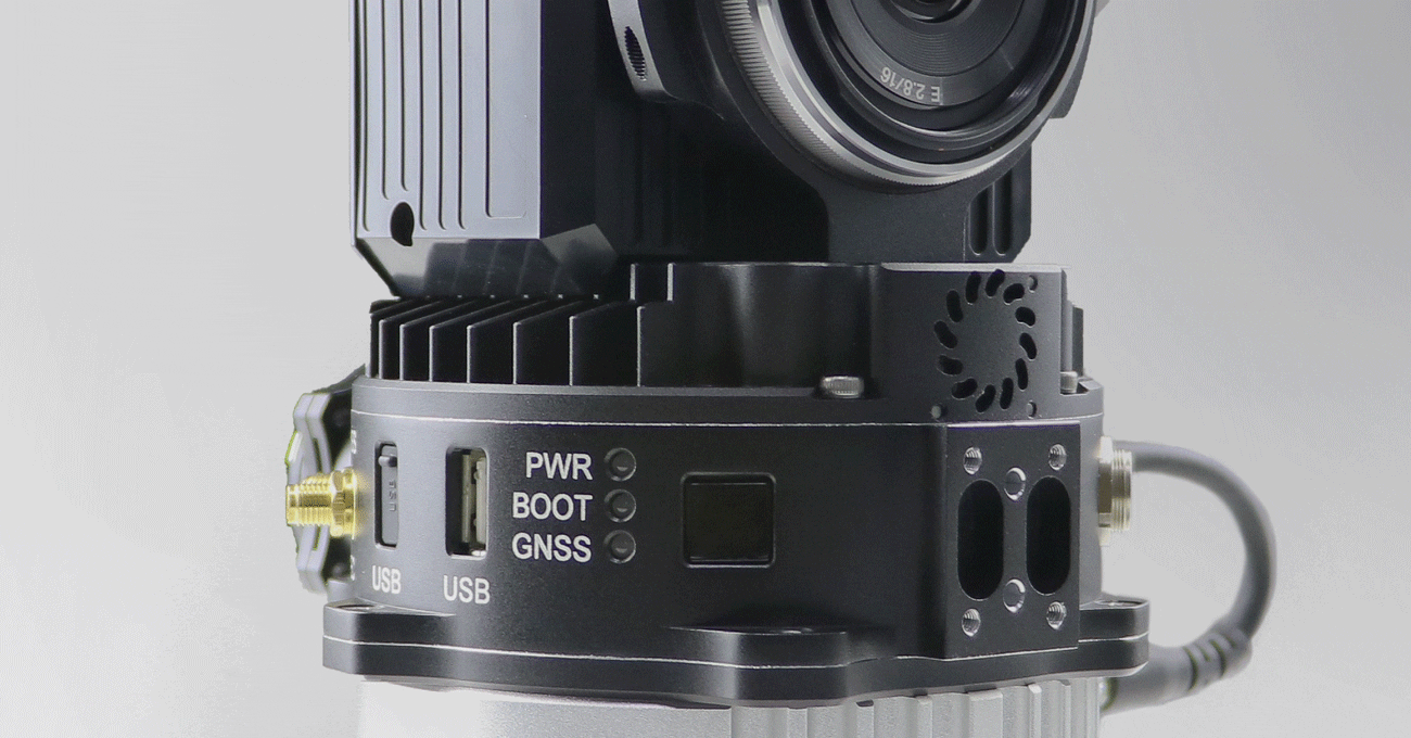
The MVP LiDAR system is ready for work as soon as powered on and free of additional calibration. Light weight and low consumption allow up to 35 min Flight Time (DJI M350). 360°FOV provides broad coverage of working area.
Streamlined Workflow
Easy field work operation with one-click button or web interfaces. Fully automated data processing by one simple click without manual configuration of complex parameters.
High Accuracy
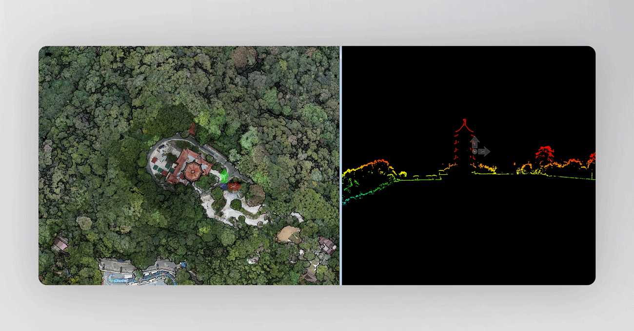
By combining advanced GNSS and IMU system, supported by Tersus self-developed PPK/RTK algorithm, MVP achieves 3cm horizontal and vertical accuracy. Sample data was collected with DJI M350 at 80m flight height, please download drone platform data↓ or vehicle platform data↓.
Powerful Point Cloud Software
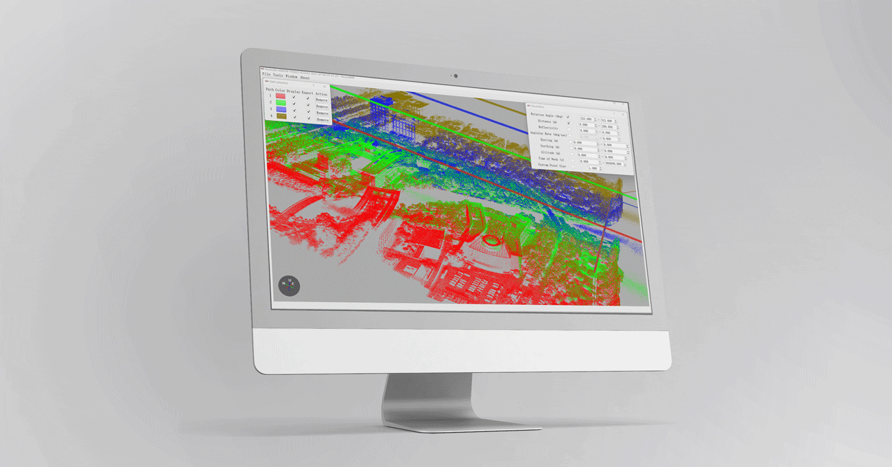
TersusMVP is a user-friendly point cloud pre-processing software, which can automatically process trajectory, LiDAR georeferencing and image colorization. Flexible cloud filter allows to select desired scanning angle, distance and time. Coordinate system selection function supports local coordinate result output. More powerful features are keeping added continuously.

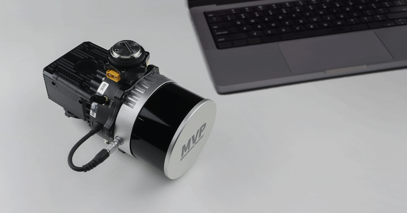
MVP is a mobile mapping system that can rapidly capture rich geospatial data while mounted on mobile platforms. As a cost-effective and high-precision mobile mapping application, it utilizes the high-performance GNSS-aided inertial navigation system (INS) and Tersus’s patented GNSS receiver and supports RTK/PPK processing. You can choose between two models available, both of which can meet different requirements in the field.